
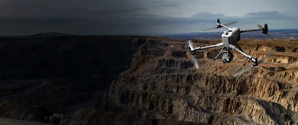
UgCS Expert:
Professional Drone Flight Planning for LiDAR and Geophysical Surveys
The desktop flight planning software trusted by 5,000+ drone teams worldwide. Plan complex LiDAR, magnetometry, and photogrammetry missions with precision terrain following, 3D preview, and full offline capability. Sold and supported in Australia by Geo Drone Solutions.
Expert is the tier with the LiDAR and magnetometry toolset, which is what most Australian survey and geophysics work needs.
Geo Drone Solutions is the Australian distributor. We sell the licences, train your pilots, and support you locally.
.webp)
Built for the missions other planners can't handle
UgCS Expert goes well beyond basic waypoint planning. It's the only desktop flight planning software with dedicated toolsets for LiDAR surveys, magnetometry, and large-area geophysical operations.
LiDAR survey planning
Plan scan patterns from your sensor's field of view, set DJI Zenmuse payload parameters inside the flight plan, and add automated IMU calibration legs with smooth cornering to keep noise out of your line endings.
-
DJI L1, L2 and L3 payload setup in-plan on M350 and M400, no bouncing to DJI Pilot 2
-
Sensor profiles for DJI L-series, ROCK Robotic and YellowScan, with FOV filled automatically
-
Add your own sensor profile by name and field of view
-
LiDAR Area and LiDAR Corridor planning tools
-
Figure-eight IMU calibration routes, and calibration actions at turns
-
Adjustable corner radius, loop turns and buffer zones


Precision terrain following and custom DEM import
Hold exact altitude above ground across fast-changing terrain. Import your own high-resolution DEM and DSM in GeoTIFF for accuracy that standard elevation databases can't reach.
-
Smart AGL checks clearance below, ahead and to the sides
-
Terrain following now works on waypoint segments, so transit legs hold clearance too
-
Import custom DEM and DSM data from .TIF files
-
Fly as low as 8m AGL using your own elevation models
-
Full offline maps and mission planning, no internet required
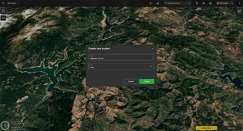
Magnetometry and geophysical surveys
Magnetometers are sensitive to flight behaviour. Abrupt heading changes at line endings, inconsistent altitude over rough terrain and speed variation through turns all introduce noise. UgCS Expert addresses this at the planning stage.
-
Trajectory smoothing for cleaner turn-around data
-
Large-area splitting with guaranteed grid alignment across sub-areas
-
Tie lines for QA/QC validation inside the flight plan
-
Shift Right to match historical survey grids for long-term monitoring
-
Compatible with Geometrics, SENSYS and QuSpin magnetometers
Desktop 3D mission planning
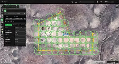
Unlike controller-based flight apps, UgCS runs on your desktop with a full 3D mission preview. Spot overlap gaps, altitude drift and missed strips before you fly, not after you process.
-
Route import from KML and CSV, including camera triggers, zoom, yaw, POIs and turn types
-
UgCS Cloud sync to DJI controllers, and to Android controllers running QGroundControl for ArduPilot and PX4
-
Automatic battery resume at swap points
-
Geo-referenced image import, map overlays and custom no-fly zones
-
ADS-B receiver support and automatic telemetry recording
Buying UgCS through Geo Drone Solutions
SPH Engineering builds UgCS. We are their Australian distributor, so the licence, the training and the support all come from one place, in your timezone.
Licences and renewals
Quoted and invoiced in AUD on Australian payment terms. No overseas card payments or currency conversion on your books.
Training on your kit
We train your pilots on the drones and sensors you actually own, not a generic curriculum. In person or online.
Support in your timezone
Call 1300 900 303 during your working day. We escalate to the SPH product team when it needs to go there.
The rest of the workflow
We also supply the LiDAR sensors, drones and processing software either side of UgCS, so it's one supplier end to end.
Complete feature overview
UgCS Expert includes all UgCS Pro features plus the full LiDAR and geophysical survey toolset.
LIDAR AND GEOPHYSICAL TOOLS
-
DJI L1, L2 and L3 payload configuration in-plan
-
Built-in and custom LiDAR sensor profiles
-
LiDAR Area and Corridor planning
-
IMU calibration routes and turn actions
-
FOV-based flight line spacing
-
Adjustable corner radius and loop turns
-
Adjustable LiDAR area buffer size
-
Large-area project splitting
-
Tie lines for QA/QC validation
-
Shift Right for historical grid matching
-
Trajectory smoothing
FLIGHT PLANNING AND OPERATIONS
-
3D flight planning with terrain preview
-
Smart AGL terrain following on survey and waypoint segments
-
Offline maps, fly without internet
-
Photogrammetry, facade, corridor, SAR, circle, perimeter and area scan
-
KML and CSV route import with actions
-
DEM and DSM elevation import (.TIF)
-
Automatic battery resume
-
Automatic telemetry recording
-
Custom no-fly zones and map overlays
-
ADS-B receiver support
-
Compatible with UgCS Mapper
Applications
UgCS Expert is the go-to flight planner for professional teams working across survey, mining, research, and infrastructure.
.png)
LiDAR Mapping and Surveying
Corridor mapping, area surveys, and volumetric calculations with purpose-built scan pattern tools and IMU calibration.

Research and Academia
Repeatable mission templates, hyperspectral sensor support, and peer-reviewed methodology for longitudinal studies.

Mining and Mineral Exploration
Large-area magnetic surveys with sub-area splitting, tie lines, and historical grid matching for ongoing geological monitoring.

Oil, Gas, and Pipelines
Pipeline corridor inspections, methane detection flights, and remote site operations with no connectivity required.

Construction and Engineering
3D mapping, stockpile volumetrics, and site-wide surveys with custom DEM import and full offline capability.

UXO Detection
Unexploded ordnance surveys with magnetometer integration, precise grid control, and trajectory smoothing for clean data.
Supported drones and sensors
UgCS Expert works with DJI, Inspired Flight, Freefly, Autel, and MAVLink-compatible platforms. One software for your entire fleet.
SUPPORTED DRONE PLATFORMS
-
DJI Matrice 400 Series
-
DJI Matrice 4 Series
-
DJI Matrice 350 RTK
-
DJI Matrice 300 RTK
-
DJI Matrice 30 Series
-
DJI Mavic 3 Enterprise Series
-
DJI M600 / M600 Pro
-
DJI Inspire, Phantom Series, Mavic Series
-
Inspired Flight IF800, IF1200, IF1200A, IF750
-
Freefly Alta X, Astro
-
Autel EVO Max 4T/4N, EVO II Series
-
MAVLink-compatible (Pixhawk with ArduPilot/PX4)
-
Acecore, Aurelia, Hexadrone, Wispr, and more
COMPATIBLE SENSORS
-
DJI L1, L2, L3 LiDAR
-
TrueView LiDAR systems (GeoCue)
-
YellowScan LiDAR systems
-
Rock Robotics LiDAR
-
Geometrics MagArrow Mk2 magnetometer
-
SENSYS MagDrone R1/R3/R4 magnetometer
-
QuSpin Gen-2 magnetometer (via MagNIMBUS)
-
Radar Systems Zond Aero GPR
-
Echologger and EchoNIMBUS echo sounders
-
Pergam / Axetris methane detectors
-
Ebinger VEMOS AIR metal detector
-
Most third-party LiDAR sensors on supported drones
UgCS Expert is not restricted to any specific LiDAR sensor. Most sensors work as long as they are carried by a supported drone platform. Contact us if you need to confirm compatibility with your specific hardware setup.
.png)

