top of page

Case Studies
_edited.png)


TrueView on Campus: University of North Georgia
Since 2010, Zac Miller has been teaching geospatial classes ranging from focuses on software processing to data collection at the...
2 min read


How City of Miami Beach Digitized Seawalls using TrueView
Problem? Rising sea levels and high tides continue to make a noticeable impact on coastline communities and the environment. As a result,...
2 min read


The TrueView 410 and Steep Terrain Drone LiDAR Mapping
Author: Lewis Graham The Challenge We recently performed a drone LiDAR Mapping experiment with a GeoCue TrueView 410 client. The test...
3 min read


Basic Volumetric Analysis Collected with 3D Imaging Sensor
Raw Data to Colorized Point Clouds True View Evo, based on our widely-used GeoCue LP360 software, is bundled with every True View 410 3D...
6 min read


UAV LiDAR/Imagery Sensor TrueView 410 in Rapid Response
What is GeoCue's TrueView 410? GeoCue’s UAV LiDAR/Imagery sensor, TrueView 410, is a 3D Imaging Sensor (3DIS) with bundled drone mapping...
4 min read


Drone LiDAR Accuracy
Evaluating Surveyor Needs vs. Wants We have a very conservative network accuracy specification of 5 cm RMSE for our True View 410...
4 min read


Mining and Construction: Stockpiles Overgrown with Vegetation
3D view of Stockpile Toe Client: Wiregrass Construction The Challenge Wiregrass Construction has been using GeoCue’s drone imaging and...
2 min read


Flood Risk Analysis: City of Miami Beach
Seawall details with Profile View in True View Evo The Challenge We all have Global Warming fatigue, but a look at the shoreline in very...
1 min read


Fixing Time-Consuming Inventory Collection
The Challenge We conduct a core product inventory every quarter for our bark and pumice stockpiles to keep our bookkeeping updated. Our...
2 min read


Direct Geopositioning Accuracy using AirGon Loki
Introduction In September of 2017, AirGon LLC released Loki, a direct geopositioning system for the DJI Inspire 2 drone as well as...
10 min read


Firmatek: UAV LiDAR Ground Topography Scanning Project
Our longtime partner, Firmatek, walks us through a ground topography scanning project using our TrueView 410 3D imaging system (3DIS). ...
4 min read


Drone LiDAR: TrueView Accuracy Testing with Caltrans
Author: Lewis Graham GeoCue Group Inc. has been involved in the testing of survey-grade instruments on small Unmanned Aerial Systems...
4 min read


Groundtruth Exploration: Surveying Projects Utilizing TrueView 410
Author: Roger O'Neill GroundTruth Exploration (GTE) has been delivering drone photogrammetry surveys for years, and as we all know, UAV...
4 min read


Bluff Profile Analysis along Lake Michigan
Figure 1 - Oblique aerial photo of profile 12-15 on Lake Michigan shoreline The Challenge Much of the Lake Michigan shoreline in...
4 min read


Identifying Building Heights over 32 ft for the City of Franklin Fire Department
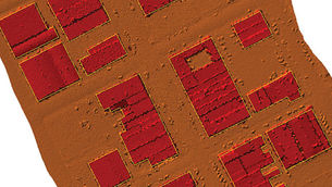
The Challenge Use LIDAR data to identify buildings over 32 ft (3 stories) in height for the City of Franklin Fire Department to maintain...
2 min read


Southwest Florida Water Management District: LIDAR for Building Elevation Data
When Hernando County Florida needed 3D model of the City of Brooksville, it turned to the Southwest Florida Water Management District (SWFWM
3 min read
bottom of page
