

.png)
CAD AND AR VISUAL STAKEOUT
Up to 40% faster stakeout with design data overlaid on the live camera view
The i76 brings your CAD base map into an augmented reality view, so you can see exactly where each point sits on the ground before you walk to it. Dual 2 MP wide-angle cameras (95° field of view) give a clear picture of the site, making path planning simple and cutting out unnecessary back and forth. It's ideal for pipeline alignment, landscaping, building foundations and general construction set-out.
HIGH-PRECISION GNSS POSITIONING
96%+ fixed RTK rate, even in high solar activity regions
Powered by a 4th generation air-medium GNSS antenna and CHCNAV's iStar 2.0 engine, the i76 tracks GPS, GLONASS, Galileo, BeiDou and QZSS across 1408 channels. Ionospheric interference suppression and strong multipath resistance keep your fix stable when conditions get tough, delivering up to 0.8 cm horizontal and 1.5 cm vertical precision. Reliable data, first time, every time.

.jpg)
5TH GENERATION ULTRA-IMU
60° tilt compensation with accuracy within 3 cm
The interference-free Ultra-IMU runs at 200 Hz and compensates for pole tilt automatically, with no manual initialisation and no need to centre the bubble. Pick up building corners, kerbs and hard-to-reach points without fuss. CHCNAV reports a 30% improvement in measurement efficiency, helping your crew get more done in less time.
SMART BASE AND ROVER RECEIVER
GNSS, IMU and dual cameras with a built-in 410 to 470 MHz UHF radio
The i76 brings GNSS, IMU and dual wide-angle cameras together for real-time measurement and stakeout with clear visual feedback. Its built-in UHF radio transmits and receives, so the i76 can run as a base or a rover, giving you a complete base and rover RTK set-up with a single pair. Bluetooth, Wi-Fi and NFC make connecting to your controller quick, and it works seamlessly with CHCNAV LandStar software.


COMPACT AND LIGHTWEIGHT DESIGN
Just 450 g, 40% lighter and 50% smaller than industry standard
At just 106 × 55.6 mm and 450 g, the palm-sized i76 is easy to carry and easy on the arms over a full day in the field. Less weight on the pole means better handling, faster moves between points and a more comfortable experience for surveyors on long jobs.
DURABLE AND ROBUST CONSTRUCTION
IP68 rated, 2 m drop resistance, built for the toughest conditions
Built to handle harsh Australian conditions, the i76 features a biomimetic structure and sapphire camera lenses that resist shocks and scratches. With IP68 protection against water and dust, 2 metre drop resistance and an operating range from -40°C to +65°C, it keeps working wherever the job takes you. The energy-efficient battery delivers more than 17 hours of operation in RTK rover mode.


OVERVIEW
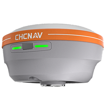
The CHCNAV i76 Palm Visual IMU-RTK GNSS packs GNSS, IMU and dual cameras into a compact, palm-sized receiver. With CAD AR visual stakeout, a 96%+ fixed RTK rate, 60° tilt compensation and a rugged IP68 build, it delivers centimetre-level accuracy without the bulk. Available in Australia through Geo Drone Solutions, an authorised CHCNAV reseller, with local training and support.
450 g
Palm-sized, lightweight
receiver
96%+
Fixed RTK rate in high
solar activity regions
40%
Faster stakeout with
CAD AR guidance
17 hrs
Battery life in
RTK rover mode
60°
Tilt compensation
within 3 cm
IP68